

Adress
Yácatas de Tzintzuntzan. Michoacán. México.
GPS
19.6231423, -101.57377963449
Send an Email to
Monday
09:00 – 17:00
Tuesday
09:00 – 17:00
Wednesday
09:00 – 17:00
Thursday
09:00 – 17:00
Friday
09:00 – 17:00
Saturday
09:00 – 17:00
Sunday
09:00 – 17:00
KNOW MORE PLACES
VISITA OTRAS LOCALIDADES
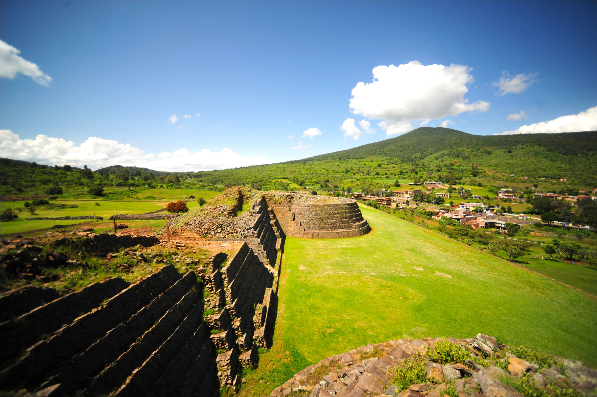
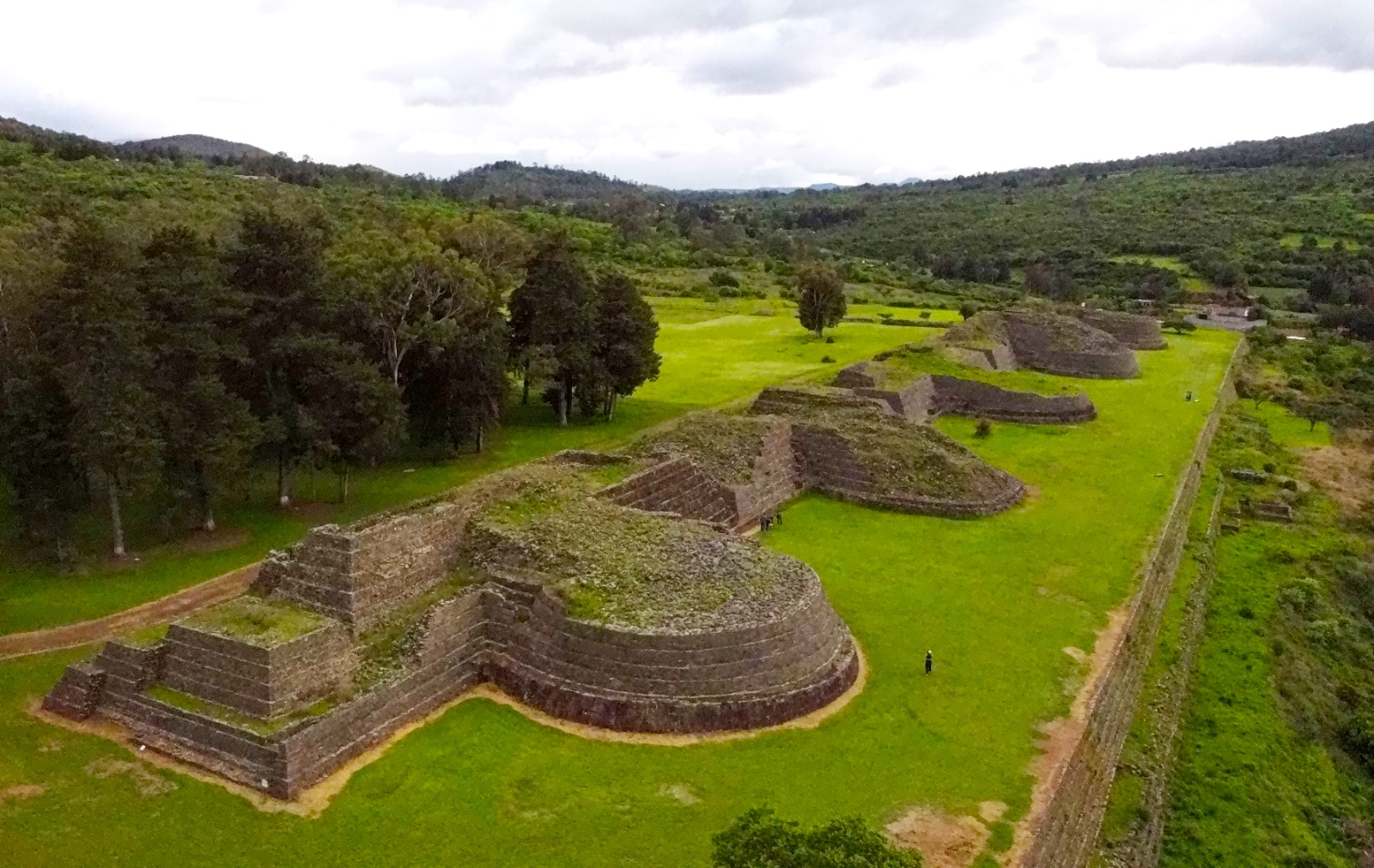
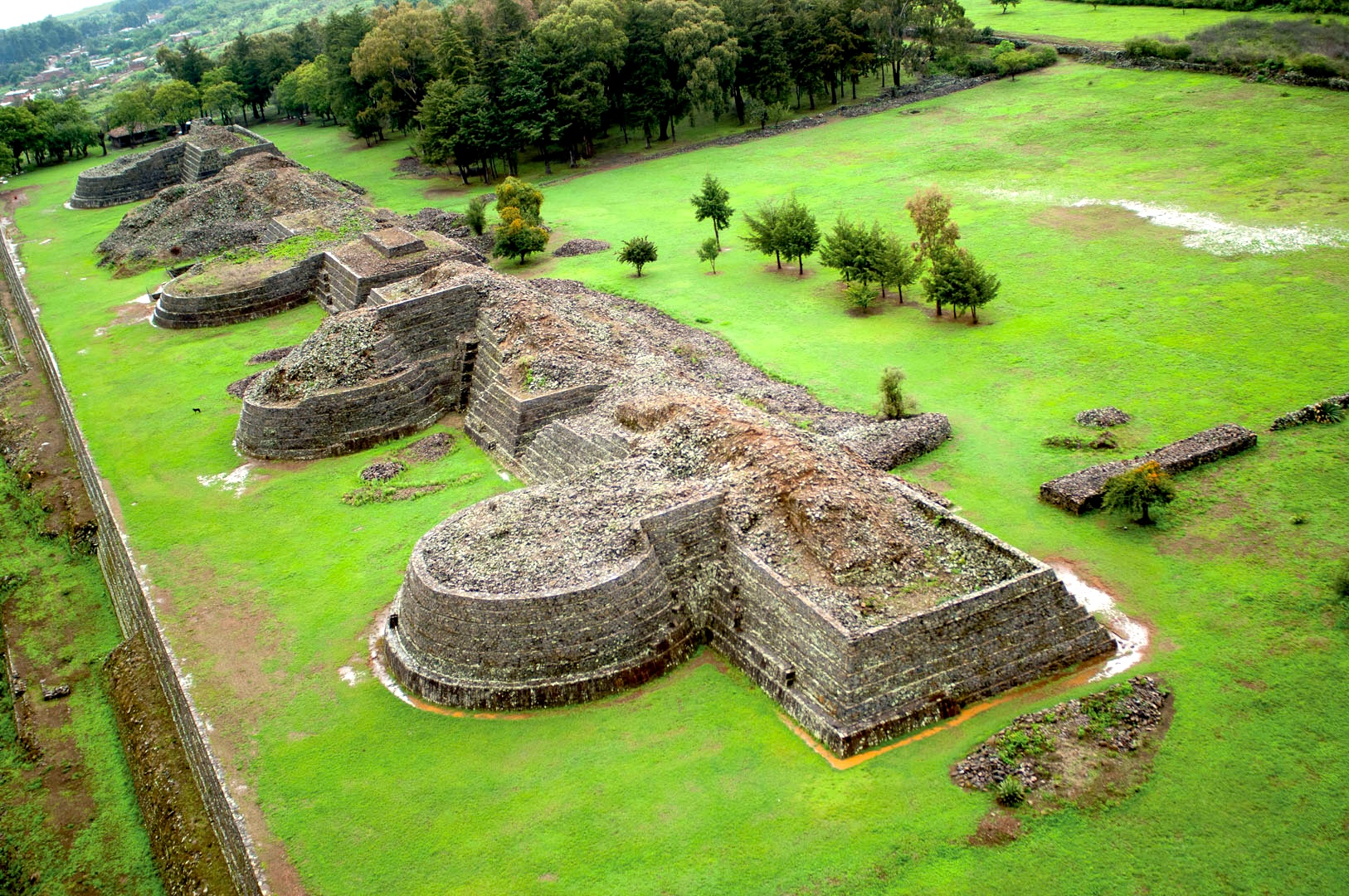
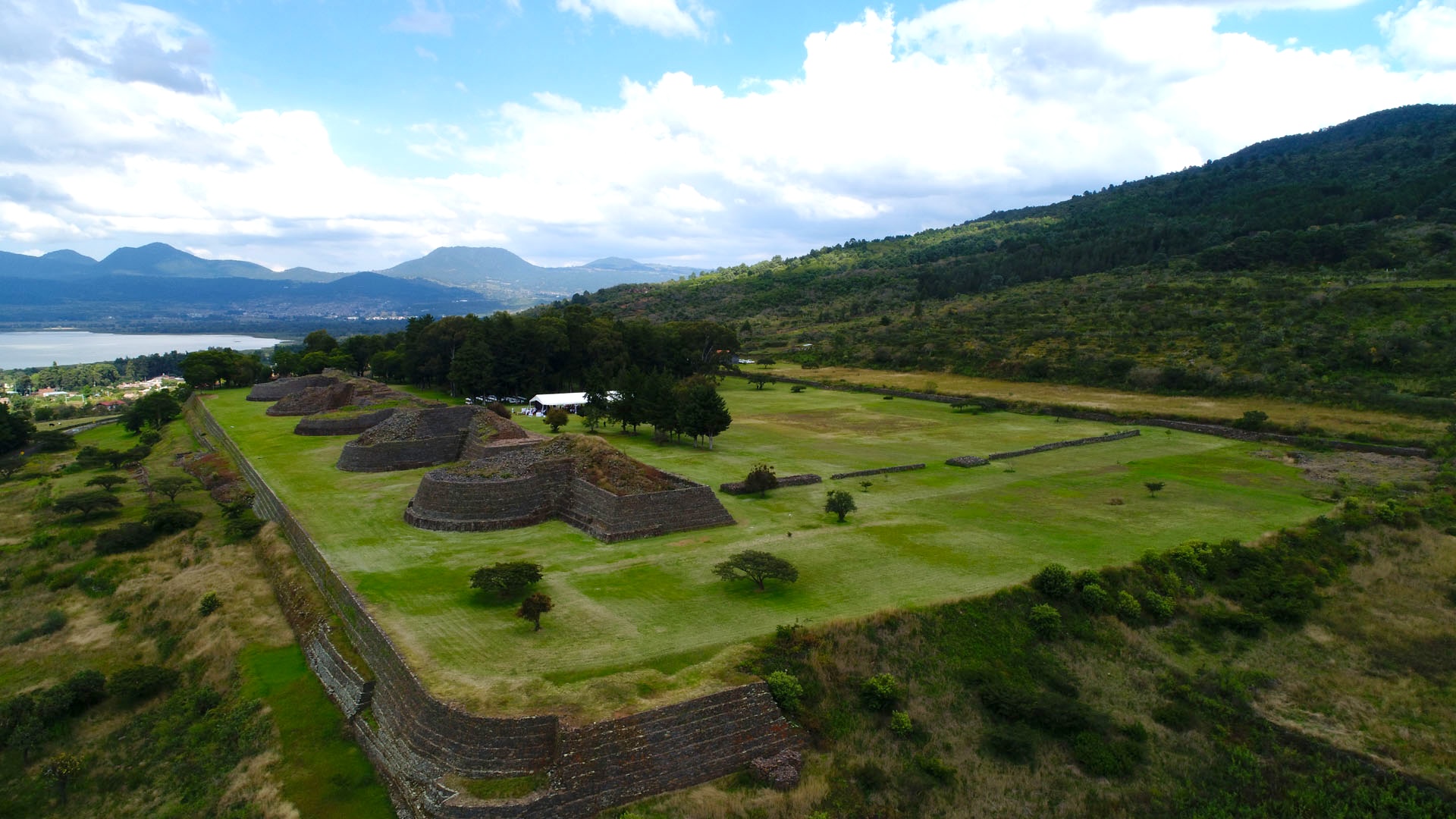
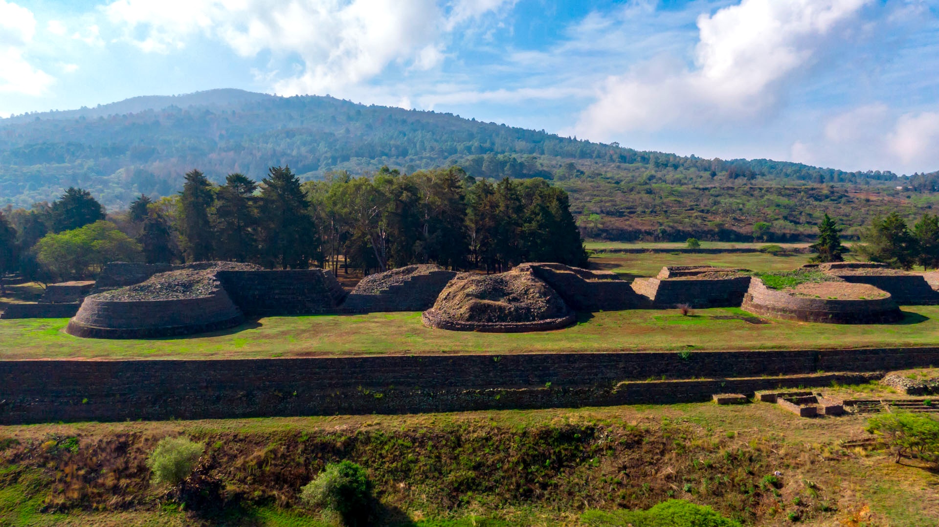
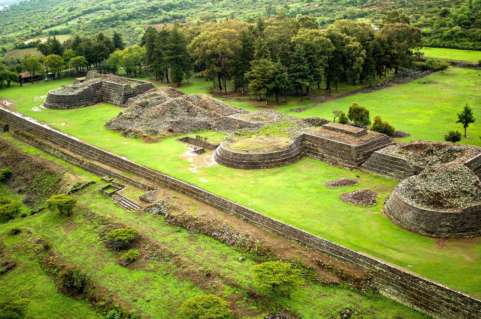
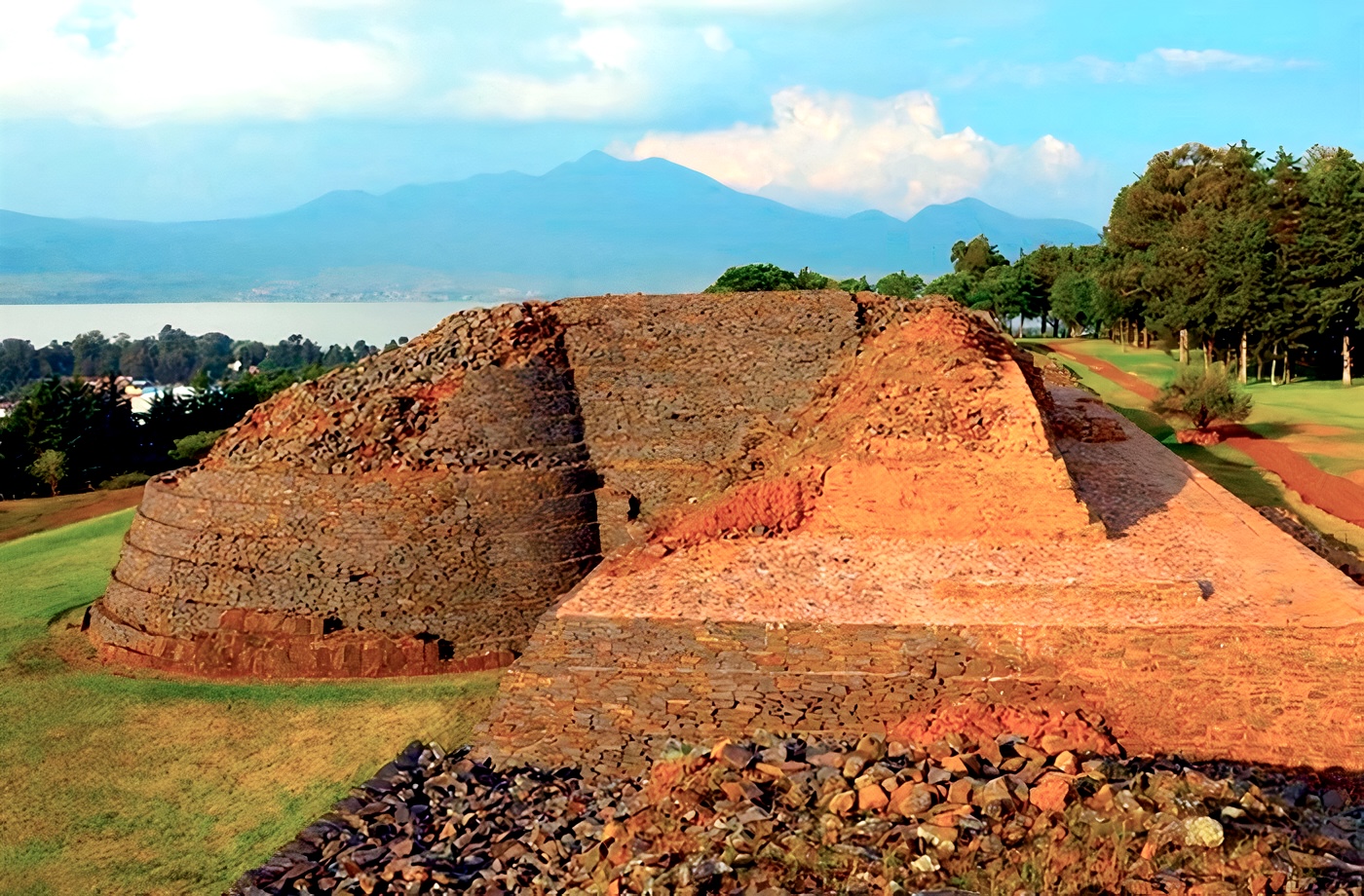
Tzintzuntzan, located in the heart of the Lake Pátzcuaro basin, was the last great capital of the Purépecha empire. Political, economic and religious life were controlled from there. Its location on the slope of the Yahuarato hill allowed for visual control of a large part of the basin and its protection on the southeastern side was ensured by the hill itself. Two periods of occupation of the site can be seen from the architectural structures: a large artificial levelling of the hillside on which the buildings visible today are located and a substructure of said levelling and of the buildings known as yácatas.
Most of the information about the pre-Hispanic foundation of Tzintzuntzan is found in a 16th-century document called “Relation of the ceremonies and rites and population and government of the Indians of the province of Michoacán” by the friar Jerónimo de Alcalá. This document narrates how, upon the arrival of the Purépechas to the basin of Lake Pátzcuaro, they established strategic alliances with the ancient inhabitants of the islands and the mainland. They later consolidated themselves as a hegemonic group, having the city of Tzintzuntzan as their headquarters. From reading the historical documents, it can be inferred that the growth of Tzintzuntzan could have been due to political-religious reasons, since it was an administrative city. The year 1450 is mentioned as the date of the city’s foundation, that is, during the post-classical period.
Archaeological research began in the region at the end of the 20th century. The first reference to the existence of archaeological remains in Tzintzuntzan dates back to 1855, when Beaumont highlighted what were the main Purépecha settlements: Patzcuaro, Tzintzuntzan and Ihuatzio.
The oldest antecedent of archaeological studies on the site is the work of Dr. Nicolas León in 1888, when he described the characteristics of the buildings and provided a brief history of the site, highlighting the interventions that caused great destruction.
In 1930, Caso and Noguera carried out the first excavation in Tzintzuntzan. Their results were not entirely favourable, due to the poor soil formation, which resulted in enormous difficulty in identifying the stratigraphic layers that would show us the temporal sequence of the archaeological remains and occupations.
En 1937 dió inicio una serie de once temporadas de trabajo en la zona arqueológica, teniendo como principales objetivos la limpieza, la consolidación y la reconstrucción de los elementos arquitectónicos, así como la realización de investigaciones paralelas. Esa primera intervención se llevó a cabo bajo la dirección del doctor Alfonso Caso, quién exploró la yácata número 5 y consolidó el lado norte y la esquina noroeste de la misma estructura.
The second season of work was in 1938, directed by Alfonso Caso himself with the collaboration of prominent researchers such as Jorge R. Acosta, Daniel F. Rubín de la Borbolla and Armando Nicolau. The work was directed towards consolidating the structures; some burials were excavated and an attempt was made to define the temporal sequence of occupation of the site, based on stratigraphic excavations. A part of the semicircular body of yácata 5 was cleared. The foundations of building A (colonial element) were found and building B was discovered.
The archaeological zone was opened to the public after the first restoration and consolidation works were completed, at the end of the 1930s.
In the third season directed by De la Borbolla in 1940, the consolidation and reconstruction of yácata 5 was completed and buildings B and C were excavated. In 1942, Rubín de la B. himself and Ramón Galí carried out the fourth season of work, the goals of which were to carry out a detailed topographic survey of yácata 5 and to make stratigraphic wells to support studies of local ceramics.
In 1943 and 1944, Rubín De la Borbolla directed the fifth season, with the aim of learning about the different types of burials and the offerings associated with them. In the sixth season, carried out in 1946, De la Borbolla explored the rectangular body located between yácatas 4 and 5.
The seventh season was carried out in 1956 under the coordination of Rafael Orellana, who consolidated part of the rectangular body of Yacata 1, excavated three pits and managed to detect some burials.
In 1962 and 1964, Dr. Piña Chan worked in the area, reconstructing and consolidating the front of yacata 1, the wall of the large platform and the levelling that provided access to the site located northeast of said platform. A colonial room was discovered (building D), exploration of building B continued, detecting an altar outside, and yacata 5 was excavated to define the construction system.
In the ninth season (1968) directed by Piña Chan, the Barrio de Santa Ana located in front of the yácatas on the northeast slope of the Tariácuri hill was explored, the stepped bodies of yacatas 1 and 5 were reconstructed as well as the west and south faces of the Great Platform and attempts were made to reconstruct the levels and stairs that gave access to the ceremonial center.
During the 1970s, Hellen Pollard (1970 and 1972) carried out surface explorations in the area, achieving a very precise recognition of the site. In her analysis, she combined the use of documentary sources, specifically La Relación de Michoacán, with the scarce materials found on the surface. With this work methodology, she was able to define a zoning for the pre-Hispanic city.
Between 1977 and 1978, Cabrera completed his tenth season of explorations in Tzintzuntzan. Efforts were directed toward two areas: the ceremonial area and the periphery. Exploration continued in yácatas 2 and 3 and a portion of building B; an architectural element was also discovered that he called building E, which he believes had storage as its main function. In the vicinity of the ceremonial center, he excavated a residential unit and what appeared to be an obsidian workshop.
The last season of explorations in Tzintzuntzan was led by Efraín Cárdenas in 1992. On that occasion, the northeast face of the large platform was cleared and restored, as well as its northern corner. The site museum was also built and has been operating as such ever since.